
Sketches of Flooding in Saint Paul (Part One)
The Mississippi River is flooding in Saint Paul. We've been getting a lot of rain this year and all that rainwater is draining into the river. Roberta and I have been sketching the changing landscape in Saint Paul as water replaces land. Barriers and sandbags are blocking streets and police are warning people to stay out of flooding areas (click on the sketches to make them bigger).
Yesterday I sketched the rising water on the Lowertown Landing in my small journal:


Roberta sketched this scene along the river at the Upper Landing:
Today, the river has risen dramatically. Roberta and I decided we would document the flood all day in our journals. Roberta returned to the Upper Landing to document the change:
I also sketched the flooding along the Upper Landing and Raspberry Island:
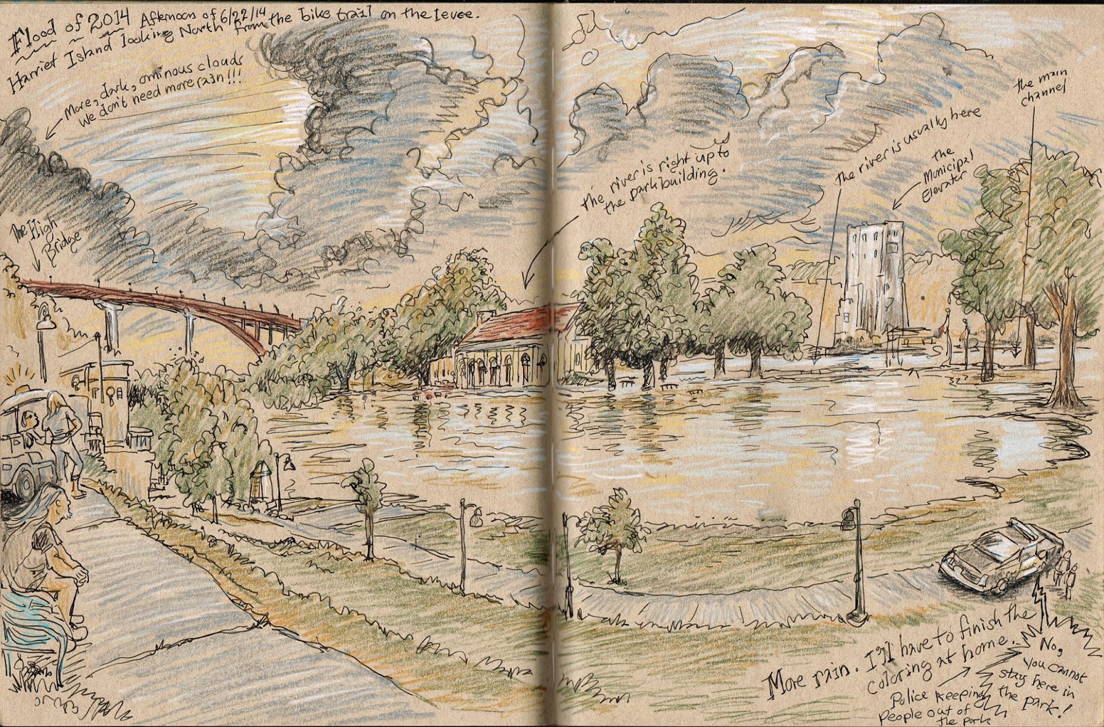
We biked over the Wabasha Bridge to sketch the flooding on Harriet Island. This is Roberta's sketch:
This is my sketch of the flooding on Harriet Island:
It rained again, so we had to stop sketching for a few hours. I biked around Lowertown after 5 PM to see how the flooding was affecting our neighborhood. The flood is just beginning to creep into Lowertown:
The forecast is for more flooding. Roberta and I will continue to document this event - stay tuned.
These are marvelous, and I want more but--- stay safe. We need all the urban sketchers the world can produce.
ReplyDeleteYes, stay safe...but keep sketching. This is fantastic!
ReplyDeleteThese are amazing sketches! Thank you for sharing!
ReplyDeleteExtraordinary work. What Urban Sketchers are all about. So much more evocative as a record than photos could ever be. Be careful won't you x
ReplyDelete